
GISmatters specializes in quantitative location analysis for business,
communications, municipal, environmental, medical, safety, and academic
applications. We apply a rich set of GIS and geostatistical methodologies
and tools to answer your questions about the spatial relationships among
the data crucial to your enterprise.
Location Analysis: Weighting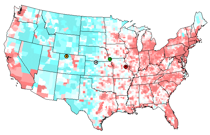
Click to see larger in another window
There are many other "centers" of the country that can be thought of similarly and calculated with GIS tools. The map above shows a few of them in addition to the geographic one (white marker): population (red), agriculture (green), and topography (orange). Each of these is another balance point of the lower 48 states, but weighted by population, or area under cultivation, or elevation instead of simply area. The blue-to-red shading of the map indicates low-to-high population density on a county-by-county basis. |