The confluence of climate change, accelerating development, and other
factors has led to a steep increase in the frequency and costs (human
and financial) of natural disasters around the country and the globe. With
our expertise in GIS and a strong background in earth system science,
GISmatters can provide cost-effective site-specific and regional assessments
of natural hazard risks. These are ideal when detailed and expensive
hydrologic or geotechnical assessments are not needed, or to prioritize
their implementation at various sites.
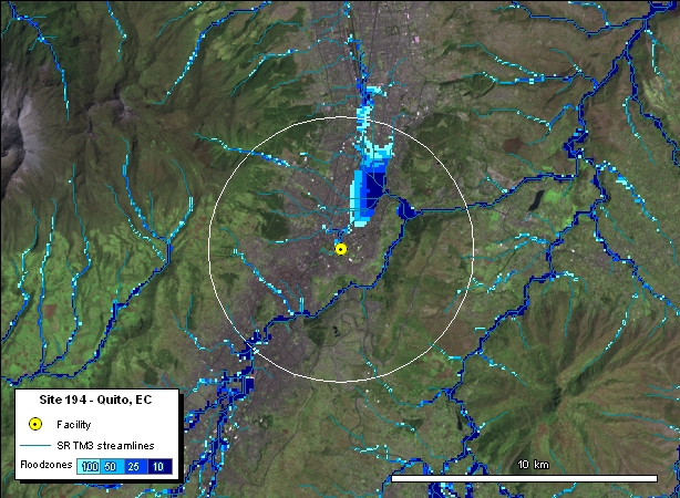
Natural Hazards: Floods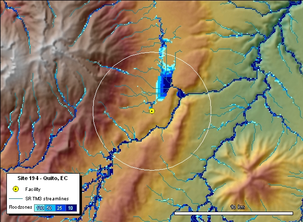
Click images to see larger in another window
The images to the right are derived from maps generated for the U.S. Department of State as part of a large multi-natural hazards assessment for hundreds of locations around the world. We used historical precipitation data to drive the flood model with 100-, 50-, 25-, and 10-year maximum 24-hour precipitation events to derive the corresponding 100-, 50-, 25-, and 10-year floods. |