
GIS has evolved into a full-featured environment for a range of modeling
approaches to analyze and predict the behavior of complex, spatially-
and temporally-varying systems. Given data and empirical or analytical
rules for system behavior, GIS can be used to implement models predicting
the evolution or expected state of the system due to the process(es) in
operation.
Modeling: Predictive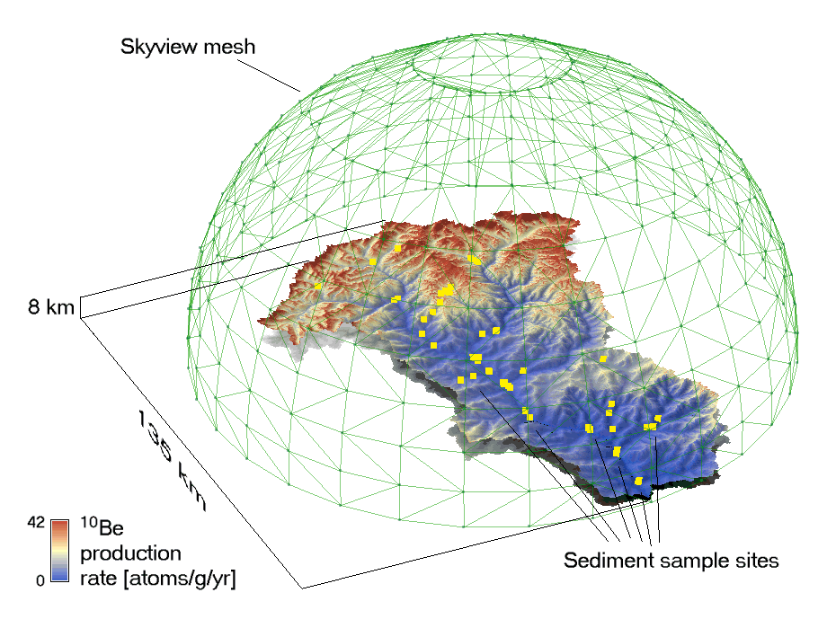
Click to see larger in another window
For this application, we computed equal-flux sectors in the sky hemisphere, accounting for the non-uniform flux from different parts of the sky, then used standard GIS visibility analysis to determine total incoming flux at each point on the surface. These values were then adjusted in a raster modeling framework to acccount for surface orientation, elevation, and latitude, and to convert from radiation intensity to cosmogenic isotope production rates. |