
GISmatters produces maps and other graphics for a variety of
publications and presentations. We work with you to understand your design
goals, identify and develop data resources, and deliver ready-to-use output in
electronic or hardcopy format, whether it's destined for print, screen, the
web, or somebody's living-room wall.
Presentation: Magazine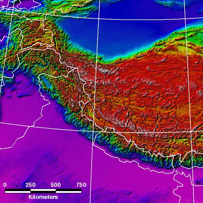
Click to see larger in another window
This map, prepared for Shambhala Sun magazine, shows false-color shaded-relief terrain of Tibet and surrounding areas, with basic map annotations such as longitude and latitude lines, a scale bar, a colorscale legend, and simplified country borders. Detailed or stylized, technical or general, we know the right data and presentation method to meet your design and communication needs. |