GISmatters produces maps and other graphics for a variety of
publications and presentations. We work with you to understand your design
goals, identify and develop data resources, and deliver ready-to-use output in
electronic or hardcopy format, whether it's destined for print, screen, the
web, or somebody's living-room wall.
|
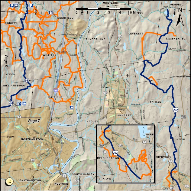
Presentation: Recreation
Click to see larger in another window
The proliferation of inexpensive GPS units has made it affordable for
many organizations to produce custom recreational maps, such as this
16-page booklet of snowmobile trails we produced for the
Snowmobile Association of Massachusetts.
The club members collected trail data using GPS units while riding the trails.
GISmatters managed the design and layout, data import (from multiple
file formats of various GPS brands), cleanup, and consolidation, and
final printing and binding of the custom-sized booklets that fit inside
protective map pouches carried on the snowmobiles.
|
|