
GISmatters provides data development and database
solutions tailored to the information and business demands of your enterprise,
whether location-sensitive or not.
We work closely with you through every stage of design, planning, development,
installation, and training to ensure the result fits seamlessly into your
operation to enhance your workflow, productivity, and ability to fully utilize
your information resources.
Data & Database: Data Development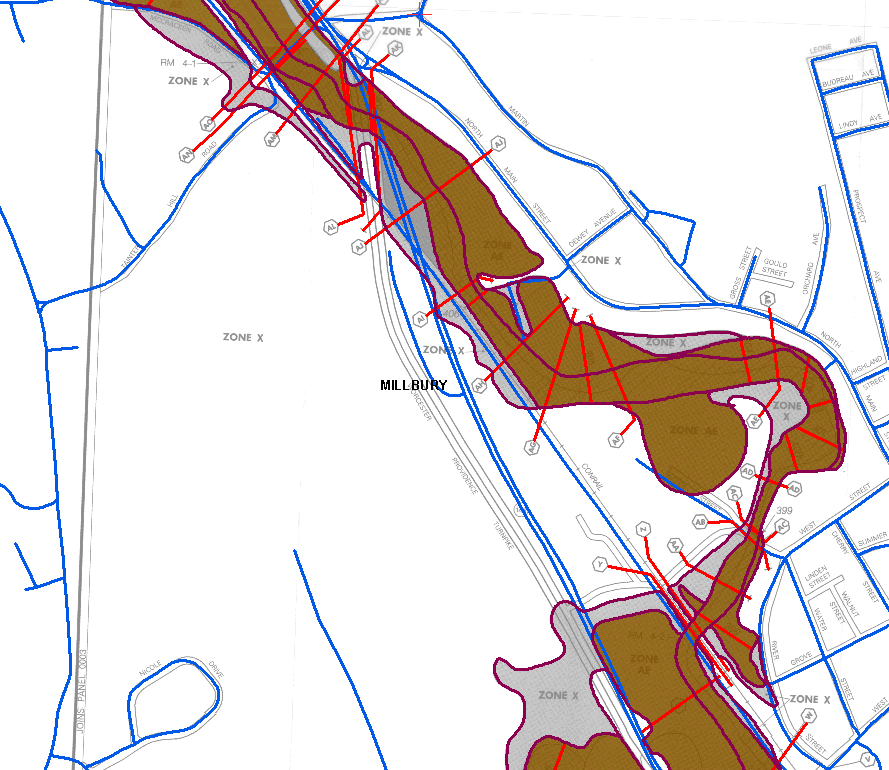
Click to see larger in another window
This example shows a typical data development task: converting paper maps into GIS format. Steps include scanning the paper maps, geo-registering the scanned image to known coordinates, converting the scanned features (streets, streams, buildings, etc) to GIS elements (points, lines, polygons), and assigning attributes to the GIS features. The maps here are FEMA Flood Insurance Rate Maps (FIRMs), being converted to digital format as part of FEMA's Map Modernization program. |