
GIS has evolved into a full-featured environment for a range of modeling
approaches to analyze and predict the behavior of complex, spatially-
and temporally-varying systems. Given data and empirical or analytical
rules for system behavior, GIS can be used to implement models predicting
the evolution or expected state of the system due to the process(es) in
operation.
Modeling: Mechanistic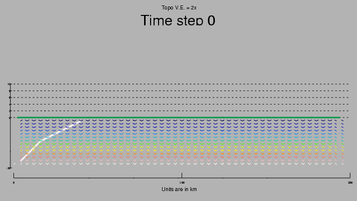
Click image for animation (477kb)
The two-dimensional model pictured here was implemented as a stand-alone, platform- independent application using the C programming language and a graphics modeling package to create a user interface for controlling and viewing animations of various deformation scenarios for a cross-section of the earth's crust under compressive stress. The model uses a finite-element approach to represent the structure and deformation of the crustal plate. This approach can be used equally effecively to model and visualize three-dimensional systems. |