GISmatters specializes in quantitative location analysis for business,
communications, municipal, environmental, medical, safety, and academic
applications. We apply a rich set of GIS and geostatistical methodologies
and tools to answer your questions about the spatial relationships among
the data crucial to your enterprise.
Location Analysis: Networks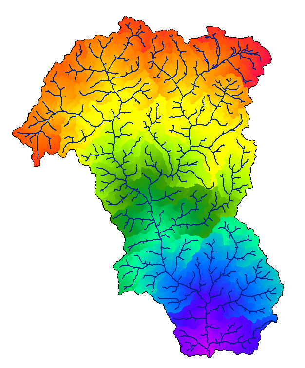
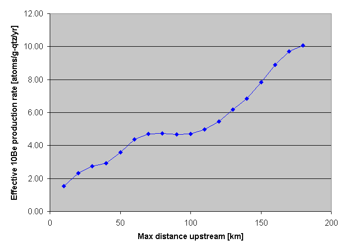
Click to see larger in another window
Click to see larger in another window
The figures here show part of an analysis of attributes distributed throughout a river drainage basin. The network and surrounding space were measured and colored by their along-network distance from the outlet at the bottom of the basin (star), then their averaged attributes (the abundance of isotopes produced by the spatially-varying cosmic ray flux) were plotted as a function of increasing distance from the outlet. These and many other network-specific techniques can be applied to problems in transportation, site selection, environmental issues, and more. |